How to measure the distance between 2 points with Google Maps from desktop browser and mobile app and measure the distance of a multi-step route
In a previous post we saw how to download the
offline maps
to be able to use them even without an internet signal. I continue in the same vein showing how it can be measure the distance how the crow flies between two points with Google Maps from desktop browser and mobile app. With both devices it is also possible to calculate the distance of a route always created in the Google Maps from desktop and mobile and consists of several steps.
Remember that it can be accessed
Google Maps
from the browser by clicking on the previous link also from the anonymous form. The services of Google they will identify our position and show the geographic area in which we are located.
Google Maps but can also be used by
mobile devices installing the related applications:
- Google Maps
per android; - Google Maps
per iphone AND iPad.
To calculate the distance between two locations, place a position marker at the starting location and click on the arrival location, or right-click on the starting location and choose
Driving directions from here then click on another point on the map or type its name in the search box.
The following road route will be shown with the mileage and travel time depending on the chosen means of transport. It is, therefore, a distance that is a function of the roads that connect the two places.
You can also go left and click
Add destination to create a
path
of which to obtain the distances of the individual stages and travel times. In this post we will see how to calculate the
away as the crow flies
between two points with the browser and the mobile application, also measuring the distances of a
itinerary.
I posted on
Youtube channel
a tutorial in which I illustrate how to measure the
distances as the crow flies between points.
Let's start seeing how to calculate distances between 2 points or a polygon with Google Maps opened in the browser.
The web page linked in the second paragraph opens and you look for the point where to start measuring the distance.
DISTANCES ON GOOGLE MAPS IN THE NAVIGATOR
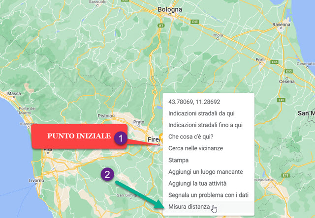
He can right click above that point to display your contextual menu.

Then click on the item Measure distance. O
Placeholder from the starting point will become a
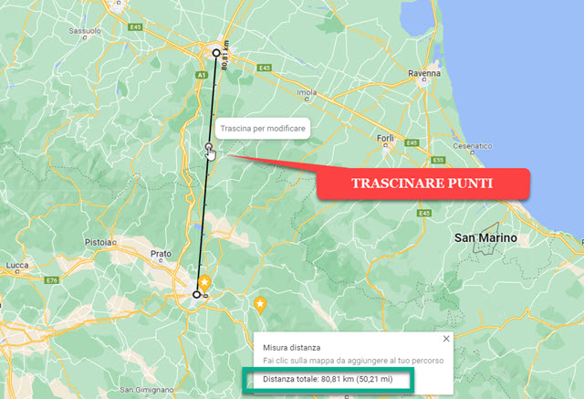
white circle with black border. Click with the cursor on the second point to display a
black line with distance.
The line can be modified by dragging its points elsewhere to create a polygon.

The distance in will be displayed at the bottom km is at
miles. Clicking the measure will close at the cross of the flag.
Going to another point on the map will add a new line from the second to third point and so on if you make further clicks.
Google Maps it will add the distances of the single lines and show the result.

To delete the measurement, right-click a point on the map and go to Cancel measurement.
DISTANCES IN GOOGLE MAPS ON THE MOBILE APP
open Google Maps about android or up
iOS. Search for a location or tap a point on the map to create a
Placeholder red at the desired point. Below you will see the Indications and the button
To start.
With the button To start The
browser
which will take us to that point on the map from where we are now. In this context we are not interested but rather
scroll down the related flag
Placeholder.

you touch Measure distance. O
Placeholder it will become a white circle with a black border. Yes drag the screen do
match this circle with the mentioned point
measure the distance with the initial marker.
In the lower left corner the straight line distance between the two points will be shown. You can do even more and tap the
More above Add point. The circle at the second point will look the same as the first.
You can then drag the screen again make it coincide with a third point of our choice.

We can iterate the procedure to create a path identified by a polygon. Below will be shown total distance all the way. Per delete the measurement is touched arrow pointing to the left.
